
Set in northern Spain and only a few miles inland from the coast, the Picos de Europa are not necessarily that well known to walkers in the UK. With jagged limestone peaks,
deep gorges, leafy forests, wonderful wildlife and a weather pattern that makes
temperature inversions a regular feature, it's a mountain lovers paradise.
I have written previously on the blog about my experiences climbing in these mountains way back in the mid nineties http://bluestoneimages.blogspot.co.uk/2014/04/memories-of-getting-high.html and until recently did not really feel that motivated to head back there. Nothing of course to do with the area, or for that matter any
negative experiences there, it was simply a case of not being capable of activities at that level anymore, I kind of felt I would not enjoy
revisiting just to walk. Having been
back, I really don't know what I was thinking.
Yes I looked up at some of the climbs I had done and the mountain
summits I would never be capable of standing on again with real pangs of sadness,
but I only had to look around me to realise there was plenty of adventure to be had.
It was the end of May and the Fuente De campsite had that just opened feel, with people busy grass
cutting, weeding and trying to get the plumbing working correctly.
It did not take us long to
get our vans set up and with a backdrop of soaring peaks we sat down to a few
beers and a bit of map studying. We had already made plans of course, but somehow it always seems easier to get down to the fine detail when you are surrounded by the hills you plan to explore. Our first objective we decided would be the mountain of
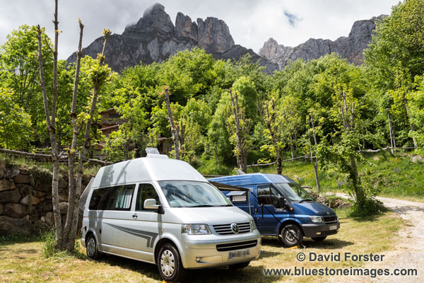 |
| Campsite at Fuente De |
Walk 1 (Veronica Hut From El Cable)
Being the end of May we expected a
certain amount of snow in the higher cols and northern aspects of some
mountains and had come equipped for such conditions. As we made our our way along the path from the cable car towards our mountain things were looking pretty good in fact. At one point some ski mountaineers passed us and it crossed my mind they may well be in for a long walk and some slim pickings the way things were.
 |
 |
| The Pozos de Llorcaza - not too much snow we thought |
As we gained height a couple of K's later, on the La Vueltona path however, we were still surprised at just how much snow there actually was.
 |
| The La Vueltona path. The higher we got the softer the snow. |
Of course snow is not just snow and depending on conditions it does acquire infinitely variable qualities. The main problem for us this morning was the fact it had not been cold enough to freeze overnight, like it or not, we would be spending most of the day struggling uphill in soft sugar snow.

At times it was hard going, even with crampons, and at the first steep section leading up to the summit, we could clearly see we were in for a steep ascent on a wet, possibly avalanche prone snow slope.
We had a little look at the start and decided a bit of
discretion was called for and came up with a plan B. Instead we would head further
up the valley on the main trod to the Veronica Hut and return the same way. It was certainly not ideal, but we did not want to bite off more than we could chew on the first day.
The last time I was here I trotted up to the hut on a half day off after tiring myself out climbing on El Naranjo de Bulnes and remember it being nothing more than an easy walk on a nice stony path. Not this time though, instead it was a fair old slog under the searing heat of an already high sun. Coupled with the glare from the snow it sapped the energy despite regular stops. Worse still, the snow played that horrible game where I would manage half a dozen secure steps and then without warning the snow would give way. Getting going again involved an energy wasting unbalanced scrabble for purchase.
The last time I was here I trotted up to the hut on a half day off after tiring myself out climbing on El Naranjo de Bulnes and remember it being nothing more than an easy walk on a nice stony path. Not this time though, instead it was a fair old slog under the searing heat of an already high sun. Coupled with the glare from the snow it sapped the energy despite regular stops. Worse still, the snow played that horrible game where I would manage half a dozen secure steps and then without warning the snow would give way. Getting going again involved an energy wasting unbalanced scrabble for purchase.
A kilometer or so later, we cresting a rise. Ahead rearing out of the snow the cliffs of the Torre de los Horcados Rojo rose directly in front of us. Just below the cliffs a thin line of tracks crossed the top edge of the snow slope. It was a simply stunning situation and despite the minor frustrations about snow conditions, I certainly had no wish to be anywhere else.
 |
| Crossing below the Torre de los Horcados Rojo. |
It was easier if more exposed going now, but our pace quickened even more when we passed an area of snow pockmarked with stones from the gully above. It was only a short section but certainly not a place to hang around in these conditions.
The slow going meant it was early afternoon by the time we got to the hut. I did feel marginally better about it when I saw the fit looking group of mountaineers who passed us earlier only just disappearing over the col ahead.
The slow going meant it was early afternoon by the time we got to the hut. I did feel marginally better about it when I saw the fit looking group of mountaineers who passed us earlier only just disappearing over the col ahead.
 |
| Veronica Hut |
The hut is in an incredible setting with a backdrop of towering peaks and bare limestone crags and we spent a pleasant half hour enjoying our lunch and watching Alpine Choughs hop around us in search of food. We would happily have stayed
longer had it not been for the biting wind that sprang up, stealing our warmth and making sitting
around and admiring the view a much less attractive option.
 |
| Making our way back, Pena Olvidada ahead |
Rather than return the same way we tried a different route back to avoid the risk of stone fall from the cliffs of Torre de los Horcados Rojos. This proved a good decision
as it also cut off a couple of steep bits, bringing us back to our ascent path
well below the worst bit. The rest of the walk went really easily and we got back to El Cable tired, but certainly not too disappointed about not bagging a summit.
Walk 2 (Remona Circuit)
Our plan today was do the
circuit of the Pena Remona, but after yesterdays conditions we
decided to go a bit more lightweight and consider leaving out the crampons. They were little help in the thawing sugar snow anyway. Instead we would simply
head up to the Canal de Pedabejo, and if conditions proved ok at the Col, we would head over and return via the Collado de Liordes and the
steep path down the Canal de Embudo back to Fuente De. If
the snow was too hard, or involved any risk, we would turn back and treat it as a
rest day.
We were of course a little
concerned that the steep descent from the Collado de Liordes may have a snow
slope at the top, but a quick look up the gully from Fuenta De suggested that
while there were several snow patches, the steep path which runs down the right
hand side of the gully was clear.
It had been mostly cloudy
overnight, but by the time we were ready to set off the sun was shining. With a hot day in store we felt a lot more
confident about leaving the winter kit behind.
I also dumped some camera gear as well and only carried my smaller mirror-less OM camera along with an L series lens instead of the 5D.
The walk started just up the
track from our campsite and passed through some nice woodland full of birdsong, sweet smelling flowers and buzzing insects. By the
time we reached an area of alpine like pasture called Campodaves on the map we
had left the shade behind and were really sweating under a blazing hot
sun.
 |
| Campodaves. The route heads up to the obvious col on the left. |
On the way were distracted from
the heat for a while when we got some really close views of around a dozen vultures we
disturbed as we passed by.

After this
little bit of excitement the path now broke away from the track and we soon
found ourselves heading up into the Canal de Pedabejo.

While certainly steep and rocky, with
the odd easily avoided snow patch, the gully was far from difficult and we made
steady progress, only stopping a couple of times to grab a few pics and take in
the view.

Near the top it flattened
out for a short distance before we met an unavoidable snow slope leading up to
the coll.

As expected the snow was
soft and sugary and could easily be walked up without much in the way of risk
should a slip occur.

Once on top we
could clearly see down to the Vega de Liordes and the little mountain hut, which
sits at the western end. There was a
long narrow snow slope leading down to it, but again the slope angle and
security of foot placements meant that this was not a problem. Had we wished,
we could have easily made our way down the rocks at the side of the slope
anyway.

 |
| The unmanned refuge is in a really nice setting surrounded by high peaks |
The Vega itself was very
boggy from spring runoff, but fortunately the path skirted this at a higher
level and apart from crossing some small soft snow fields with a couple of
detours to avoid the worst of them, we steadily made our way towards the col. On the way we were lucky enough to spot several Rebecco with their young making their way up the lower snowfields of the Pico de La Padierna.
 |
The Collado de Liordes. Graham ready to head down the steep and rather exposed Canal de Embudo.
|
As suspected from our
earlier visual inspection from the valley the snow was not an issue in the Collado de Liordes and from what we could see the zig, zag path down appeared clear. It was however a long, steep, knee jarring, and at times a quite exposed trudge. This was further enlivened by the heel
section of my 8 month old boots starting to come away. By the time we got to the bottom, I was I have to admit, pretty hot and footsore, and certainly ready for a few beers to celebrate.
Bike
Today was supposed to be a
rest day, so we decided to do a bit of mountain biking in the morning followed by a quick trip down the valley to Potes to visit the supermarket.
After a bit of a bike a hike up through the forest we had walked through yesterday, we found ourselves back at the high pastures of Campodaves. We had planned to head up to the track junction that runs over to Puerto de Pandetrave, but to be honest on seeing the way ahead involved a fair bit of up and down our hearts weren't really in it. Instead we did a bit of vulture watching and chilling in the shade and then made the bone rattling decent back to Fuente De.
After a bit of a bike a hike up through the forest we had walked through yesterday, we found ourselves back at the high pastures of Campodaves. We had planned to head up to the track junction that runs over to Puerto de Pandetrave, but to be honest on seeing the way ahead involved a fair bit of up and down our hearts weren't really in it. Instead we did a bit of vulture watching and chilling in the shade and then made the bone rattling decent back to Fuente De.

So, all in all a good few
days, a little disappointed we did not bag a couple of the higher summits
perhaps, but then again enjoying the mountains does not always mean having to
stand on top of them.
Walk 3
Today we packed up and drove
around to Santa Marina de Valdeon which is only about 10k as the crow flies
from Fuente De. By road however it is
several hours drive involving narrow winding roads through two impressive
mountain passes. Once set up at Camping
Cares, we had a little explore and a short walk into the forest, finding a nice
pool by the campsite and a bit further up the hill some serious avalanche destruction
with smashed trees, and boulders lying across the track. We also noticed that underneath the debris the snow was still iron hard.

 |
Walk 4 (Cares Gorge)
The Cares Gorge with its
high level exposed path cut into the rock is a really popular walking
route. A walk to the end of the gorge
and back the same way is about 24k or so.
There was no need for much in the way of mountain kit, other than
waterproofs and some basics such as first aid kit, a warm layer and of course
some camera kit. That said with a bit
of water and food thrown in my kit seemed just as heavy as on our mountain
days. Frustratingly we got off to a bit
of a bad start in that we got to Cain only to find the road closed due to some
kind of mountain challenge going on.
With a big vehicle and nowhere to turn around, coupled with the pressure
of 4 other cars behind us, we had to ignore the signs and push our way into the
village. Eventually we managed to do a multi point turn between some parked
cars, a restaurant and a parked motorbike.
By the time we drove back up the road, found somewhere to park, and then
walked over a kilometer back to the village we had wasted quite a bit of time.
Once we got into the gorge
proper all was forgotten as we weaved through a few short tunnels and popped
out onto the exposed path.


It may be popular and heaving with folk even in May, but the gorge really is an atmospheric place to walk. In places it is pretty exposed, although overall it is not a difficult walk. That said it is not a place to get too blase. In some places the drop is definitely of the terminal variety, yet despite this I must admit I did see some folk do some really stupid things, such as stepping back whilst taking photos right next to the edge, or people stepping right onto the edge to get past each other. I am afraid I took the selfish option and regardless of man, women, or child, when passing people coming the other way, I always tried to go for the inside line. This approach appeared to be entirely justified when early on in the walk somebody taking a photo stepped backwards and knocked into one of our group who was passing on the outside. We were switched on to such dangers anyway so no harm was done, but it did focus the mind somewhat.

As we got further down the gorge past the bridges things quietened down a bit. It is worth noting that by that time we were ready for some food and drink but it was impossible to find anywhere that had not being used a toilet. Apart from the crowds if I have one complaint it is of the sight of used toilet paper and the stink or urine at every conceivable little hidey-hole along the path. Pushing on we eventually found somewhere acceptable to stop, but even then while eating our food a couple of Spanish girls turned up and simply asked Graham and I to look away while they had a pee right next to the path. It caused a laugh on both sides, but it really did highlight how desperate some people were becoming on the 12km route. Annoyingly they just left their toilet paper behind.
The wider views down the
gorge and situation itself however were wonderful and we made it most of the
way down the gorge before turning back a kilometer or so short of Poncebos at
some old buildings.
The 12K return walk was
still enjoyable despite going the same way back and there was still plenty to
see. I have to admit though, by the end
as we walked that last km up the road to the van, my rucksac seemed to weigh a
ton and I felt pretty tired and
nauseous in the heat. Later on repacking my
rucksac ready for the next walk the reason I was so tired soon became apparent,
I had stupidly left my crampons and other surplus kit in a bag at the bottom of
my rucksac - Dohhhh.
Walk 5 (
After yesterday the old back was complaining
somewhat, so Moira and I only had a short walk to the village of Santa Marina de
Valdeon and then up onto the lower hills to do a bit of photography and stretch
the legs a little. G&S were still
feeling fit so they continued up towards the Caben de Remona and by all
accounts had a good day.
 |
| Santa Marina de Valdeon |
 |
| Plenty of Orchids at this time of year |
The following day we packed
up and based upon a single photo I had once seen of some very nice looking peaks
we headed further south to the village of Riano in search of a new walking area
to explore.
 |
| Riano |
Our initial impression of Riano was that it was a bit of a strange place in that it felt way too new for a Spanish mountain village, yet it had a really old church.

On finding the local campsite and retiring to the bar we soon found out why. This village was one of several that were flooded when a dam was built at the head of the valley. The authorities then built a new village on the higher ground and moved the church stone by stone to its current position. We had a look at some pictures of before and after and I have to say that while it is still a nice area, it lacks the wild beauty of the pre-reservoir valley.
As impressive as it was, this
large lake gave us a real problem in that most of the wonderful peaks we had
planned to climb were now on the other side. Another problem also arose in that the town
did not have any walking maps for one of the more accessible peaks we also
fancied doing.
 |
| Mountains, a lake in the way and no maps available anywhere locally arggghhh |
We were in a bit of a
quandary about what to do, fortunately the campsite owner was really
helpful and suggested a couple of alternative hills on this side of the lake.
Walk 6 (from the village of
Horcados)
Next morning found us making
our way up a wonderful gorge marked as Hoz Oscura on the map where we had some
really good views of vultures on the cliffs and circling overhead.
 |
| The Hoz Oscura provides some welcome shade on a hot day |
Onward and upwards we continued through swathes of flowers and yellow broom until we came to Puerto de Horcadas.

Here we turned south heading up towards the Pico del Diablo. At this point we were spotted by a gang of the local sheep dogs whose barking, to warn us to stay away from their animals, filled the valley.
It's worth explaining at
this point if you have not met these dogs before just what their role is. These dogs are trained to take farm animals
up into the hills on their own where they guard the animals against predators
such as wolves. At the end of the day
(sometimes several days) they then take the animals back to the lowland
pastures again. I have heard all sorts
of stories about how aggressive these animals can be and some years ago Moira
and I had one run up to us while we were having something to eat in a
coll. They are truly massive animals
and we were seriously concerned we were about to be attacked, or at least we
were until it lay down next to us, accepted a sandwich and a fuss and then
headed off as the flock passed.
The dogs today were highly
vocal and even responded to a wolf call with howls of their own. The howling
made my skin prickle, it sounded so primeval.
Moving on we headed across
the hillside and then up steep pathless terrain to the summit of Pico Hato
(1749m). The views as you would expect
were extensive and a nice cooling breeze made it a good spot to have our lunch.
 |
| Graham on Pico Hato (1749m) |
The summit also gave good
views of our next objective Pico Loto (Lotus Peak), which at 1808m was only a
little higher. It did involve losing
quite a bit of height, but that was made up by the fact it did look to have
some interesting rocky bits for a bit of easy scrambling.
Heading down to the coll we
saw the only person we were to see all day.
With greetings of hola as we passed we made our way steeply down through
flowers, juniper and numerous butterflies to arrive at the coll in good time.
Here several options were available and so we chose one, which took us steeply up through some craggy ground. With a couple of short easy scrambles thrown in for interest we soon found ourselves on the summit.
Here several options were available and so we chose one, which took us steeply up through some craggy ground. With a couple of short easy scrambles thrown in for interest we soon found ourselves on the summit.
 |
| The summit trig of Pico Loto (Lotus Peak) 1808m |
The summit itself has a trig point and
a little weather vane like structure dedicated to the local mountain
shepherds. Despite the heat of the
afternoon the air was clear and the views wide ranging, so a second lunch among the flowers seemed in order.

The descent path was
straightforward and once we reached the coll again, we broke off and followed a
small track back to the Pico Diablo.
Stops for photos meant I was
well behind the others by now and looking down into the valley I could not see
the flock of sheep and goats we saw earlier.
Wondering if they had headed back to the valley I gave out a loud whistle. Suddenly all hell was let loose and 5
massive dogs came hurtling out of the trees barking and snarling. They tore across the slope below and feeling
a tad worried I quickly caught up with the others, passed them at speed and
marched off in front. I can still hear
the laughter now.
That's about it for the trip
really. For the last couple of days we
headed to the coast at San Vicente del la Barquera and hampered a little by
rain, spent our time wandering along its beaches and visiting a couple of the
more interesting buildings in the town such as the Castillo del Rey and the
Iglesia de Santa Maria de los Angeles.
Text images copyright David
Forster www.bluestoneimages.com