Distance: 196 Miles (we did 207.5 miles)
Ascent: 16,968ft (5,172m)
Time: 5 Days
Mode: Bike packed, camping on official sites along the way
Introduction
The official 196-mile Lakes
and Dales Cycle Loop circumnavigates the Lake District passing through some of
the lesser-known parts of Cumbria and the Yorkshire Dales. With nearly 17,000ft of ascent it is a
pretty hilly route, which passes over several spectacular areas of high ground
along the way. Those ascents and
subsequent descents however are an integral part of the routes character and
make for some wonderful, if on occasions rather challenging riding.
There are many ways of
tackling the route. You could employ
our self guided method of having no fixed plan, carrying everything on the bike
and camping along the way, take the lighter self guided option of using
B&B, hostel, or hotel accommodation, or indeed use the services of a
company who arrange accommodation and luggage transfers, along with maps and
route notes (see links).
There are advantages and
disadvantages in each method of course and lugging all of your kit on the bike
is certainly not for everyone. In fact
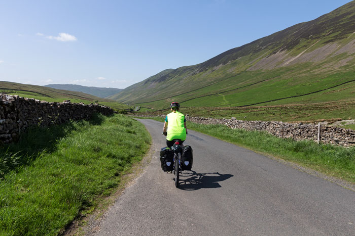
it is hard work and you may like me wonder at your sanity while struggling to
keep the front wheel on the ground as you grind your way up the steep hairpins
onto Birker Fell. This method also
takes a fair amount of planning and unfortunately as we experienced, several
campsites are away from the route and involve extra mileage at the end of each
day to get to them.
Getting to the start
The route can be joined at
any point and can be done in either direction. Penrith with its good train
links and accommodation options makes an ideal start point, as do Appleby and
Grange-over-Sands. Unfortunately if
like us you live in a rural area on the east side of the Pennines in north east
England it is impossibly complex and expensive to even consider trying to find
a way using public transport. For us a
car was really the only option, but that left us with the problem of leaving it
somewhere for 5 or 6 days and not coming to the attention of the police, or
indeed anyone else. We mulled over
various options and in doing so wondered if any of the companies who offer
cycling holidays would allow us to pay for parking on their premises. The first company I contacted was Inspiring
Cycling (see links) and while they could not offer such a service, Jason did
helpfully suggest a bike friendly guesthouse in Penrith that might. A quick email to the Norcroft Guesthouse
and John and Kim came up trumps offering a weeks parking with the fee going to
a charity they support.
Day 1: Penrith to
Sedbergh (50 miles)
Originally we had planned to
head clockwise around the route, but as the Appleby fair was to start on our
final day we opted to head the opposite way and avoid getting caught up in it.
Leaving Penrith was fairly
straight forward, however the positioning of the signs, all of which lacked
arrows hinted at the route finding problems to come. While on the subject of route finding and navigation we did try
to download the GPX files from the official Lakes and Dales Loop website, but
our Satmap 12 could not cope with the number of waypoints and simply locked
up. After several attempts I gave up
and instead cut up our road atlas, marked the route on it with highlighter and
used the GPS without waypoints as back up.
This worked fairly well although as you will read the lack of direction
arrows and poor positioning of the L&D Loop signs caused us no end of
frustration.
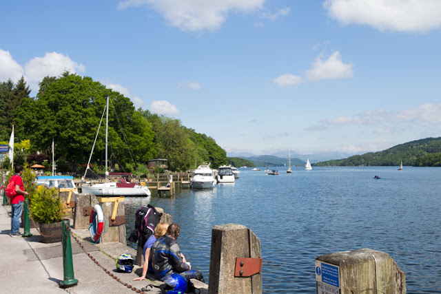
Once out of Penrith we
headed along easy quiet roads before joining the busy A686 for a short distance
to reach Langwathby. After that it was
further easy cycling through typical Eden valley villages to Dufton. Here we had a pleasant half hours rest in
the sun alongside other cyclists out on day rides at the little cafe.
 |
| A welcome break in Dufton |
Sausage buns and a couple of cups of tea
fuelled us through Appleby and onwards to Great Asby. Badly placed signs meant we headed the wrong way, wasting over
half an hour and a lot of energy heading up a steep road towards the
B6260. Once I realised our mistake it
was either head back down or continue further on to reach the B road. We opted for the latter and dropped down
into Orton feeling annoyed at going wrong so early in the route. After that we
vowed to double check the map where the L&D Loop signs were placed in
rather ambiguous locations.
Orton is supposed to have a
campsite nearby at Raisbeck, but after checking online, the number of negative
reviews made this a less than ideal option and as we still felt ok we decided
to push on for Sedbergh. From Orton yet
more faffing with a badly marked route meant checking with the map at every
junction and this slowed us down considerably.
Eventually we crossed above the M6 and began tackling the undulating
road along the lower slopes of the Howgills.
With every little stream that crossed the road involving a steep up and
down we were starting to feel pretty tired and took a break midway along to enjoy
the late afternoon sunshine and recharge the energy levels.
On reaching Sedbergh, we
were unsure where the nearest campsites were and after chatting to a local,
followed his directions until we spotted a tent and caravan sign pointing
towards the Pinfold campsite. It was downhill
all the way and thinking the day was over we cheerfully approached reception
only to be told they did not take tents.
The bloke was clearly not a cyclist and we were given directions to
sites several miles away, one of which was in Dent. We had already cycled 48 miles and it as it was after 6.00pm by
now, the thought of yet more miles was not pleasant prospect. A quick check of the map and our campsite
list showed a campsite that took tents a few miles off our route. With the only other option to wild camp we
simply had to get on with it.
After all those miles the
ascent of Holme Fell was a bit of a leg screamer and it was a relief to reach
the campsite in the valley below. The
owners were lovely friendly people and the site was in a lovely setting, unfortunately the campsite facilities
really were pretty dire, which was a shame. That said by
that stage in the day we really didn't care and were glad to have a shower,
grab some food and get some sleep.
Day 2: Sedbergh to
Grange-Over-Sands (43 miles)
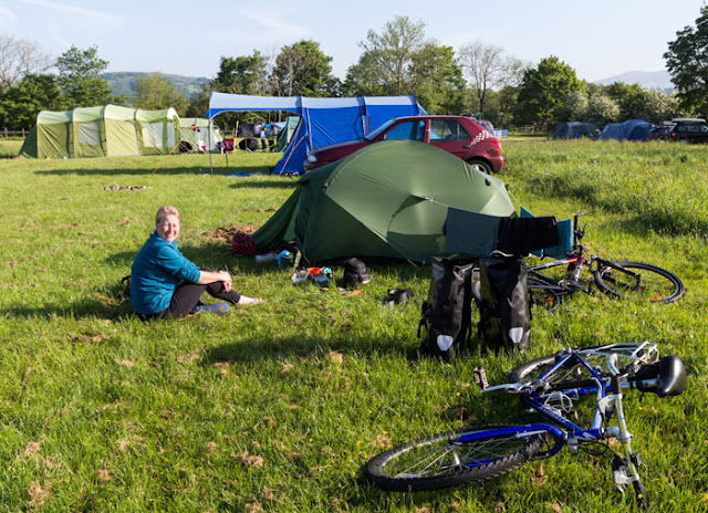 |
| Holme Farm Campsite, beautiful situation, wonderful owners, but the facilities really need updating. |
We woke to cloudless blue
skies and even the re-ascent of Holme Fell to get back on route could not
dampen our spirits. Passing into
Dentdale we made our way gently along hedge and tree lined roads towards the
pretty village of Gowthrop. Here many
of the hay meadows on this stretch were yellow with buttercups and in the
pastures lambs played in little creche like groups chasing each other along the
hedge backs.
After the initial steep
bit into the village we had a short stop for some food and drink before
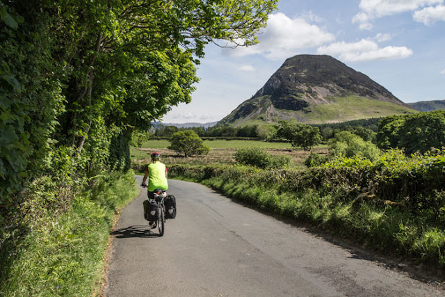
tackling the steep hill that led up to the pass. At the top we spent a few minutes recovering and savouring the
views down into Barbondale. For every
up there is a down and we soon found ourselves being swept down the road
towards the village of Barbon.
 |
| Barbondale |
Just
before the village a left turn took us along more undulations to Kirby
Lonsdale. Again the signage left a lot
to be desired and a coned off path threw us off course and onto the junction
with A65. Being a bank holiday Sunday
it was heaving with motor bikes and cars so we about turned and took the coned
off path which led sharply down to a traveller encampment just before Devils
Bridge. The area was absolutely packed
with bikers and holiday makers, so we headed up into Kirby Lonsdale in search
of a cafe. Sadly there was nowhere at
all to safely leave out bikes outside any of the cafes, and on the one we did
try we were told we could not leave our bikes there either. Being so bike unfriendly we headed to the
Spar and while I stayed with our bikes and kit Moira bought some sandwiches and
drinks to eat in the little square next door.
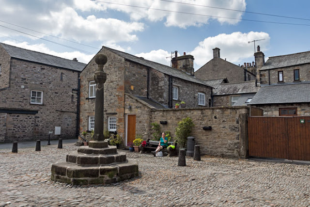 |
| Square in Kirkby Lonsdale |
On leaving a lack of meaningful L&D Loop signage again meant another
frustrating time trying to find the correct way out of town. Once we had escaped it was
back to lovely riding along quiet lanes until we crossed over the Lancaster
canal. It was such a pleasant place we
had another short break to savour the view and top up the energy levels.
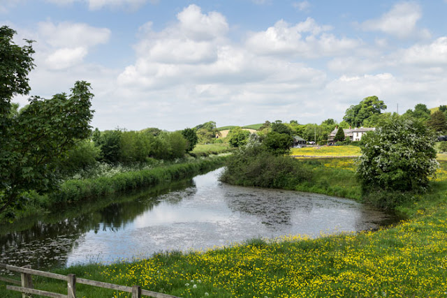 |
| Lancaster Canal |
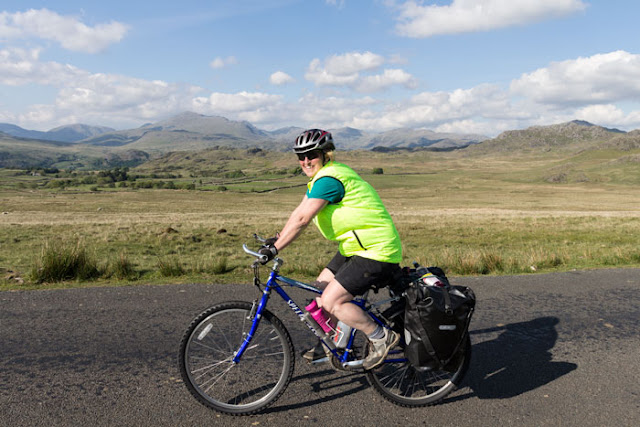
 |
| June is a lovely time to do this route |
Moving on we crossed over the M6 and made
our way along a network of quiet car wide narrow lanes just to the north of the
Kent Estuary near Levens.
 |
| M6 |
After Levens
the route headed southwest, again using a mixture of quiet roads and lanes, and
with a short section of dedicated cycle path to avoid the busy A59 it was all
rather pleasant in the swarm sunshine.
This easy cycling soon brought us to Meathrop and a few short climbs
later we dropped down to meet with the rather busy main road leading through
Grange-over-Sands. Taking the Cartmel
road we stopped off at the first campsite we came to a few hundred metres up
the hill. The reception was shut and
the place was rammed with massive tents, but on ringing the owners they said
find a spot and pitch up. Easy to say
but hard to do and we could only find a steep slope to pitch on. So steep in fact I woke several times to
find myself all squashed up at the bottom of the tent.
Day 3: Grange-Over-Sands
to Eskdale Green (40 miles).
Arriving at the reception as
instructed just after 9.00am to pay, there was nobody about. We hung around and tried ringing the number so we could at
least find out how much it was and leave the money somewhere, but all we got was
an answering machine. We had a long
day ahead and did not want to wait around for who knows how long, so told the
person living in a static caravan who helpfully came out to say they might be
around the site somewhere we would contact them and pay later (Edit - many days later and after several emails from me trying to arrange payment they tried to charge us £17.00 for a tiny mountain tent, no electric, car etc.) Fortunately there is an excellent campsite a few miles further up the road so think I will vote with my feet next time.
Yet again it was a steep
hill to start the day, but with the sun shining and the day still cool it was
no hardship and we soon found ourselves at Cartmel. The place was an absolute hive of activity with closed roads and
people arriving for the Cartmel races and the Cartmel Music Weekender featuring
the likes of Jools Holland and Simply Red.
We had planned to have a look around the village but not wanting to end
up being affected by the road closures we grabbed a sausage bun and a drink
from the shop on the corner and headed on our way. Unfortunately it wasn't long before we fell foul of the
temporary L&D Loop signs again and wasted time at every junction trying to
ensure we were still on the correct route.
Surely whoever put these signs up must have been aware that placing a
L&D Loop sign without a direction arrow on the central post of a four way
junction is absolutely meaningless.
Typically we would then arrive at the next junction only to find it did
not have a sign and we were left wondering if we had gone wrong. Eventually we made it to Newby Bridge and by
accident of yet more ambiguous signage ended up spending a pleasant half hour
next to Lake Windermere.
 |
| Windermere |
More by luck than good
judgement we somehow ended up back on route, but that said it was a real
struggle keeping it that way and we ended up exploring a couple of roads and
hills twice. We knew we had two major climbs ahead namely Ulpha Moor and Birker
Fell and at one stage were seriously thinking of ignoring the official route
and making our own way. In the end we somehow managed to find our way to
Broughton-in-Furness via the correct route.
Here we met two cyclists we had chatted with earlier in the
afternoon. Being on unladen road bikes
their prediction that they would be finishing their tea just as we arrived was
spot on and we spent a few more minutes chatting about routes, food, teashops
and the climbs we faced ahead... a typical cyclists conversations really. This conversation again highlighted the
friendliness of just about everyone we met on this ride
Standing chatting was not
going to get us anywhere and we soon headed off towards the start of the
climbing. What can we say about the
climbs here other than it felt pretty tough on some sections, yet this was more
than made up for by the rugged lakeland setting. This was especially true as we dropped down off Ulpha moor
towards Duddon Bridge.
 |
| Duddon Bridge |
Once over the
bridge we were straight into more climbing up onto the high ground above
Eskdale. With expansive views towards
the highest mountains of the Lake District it was a spectacular place to be
cycling.
 |
| Moira says she had not eaten so much in the last couple of days that she had she put weight on, it was the breeze inflating her jacket... honest |
 |
| My excuse I would like to say was also the breeze, but we all know the truth... |
On the descent into Eskdale
it was fortunate I was fully loaded and going slowly when an idiot in a white
BMW swerved onto my side of the road and drove straight at me. I was almost stopped and within a split
second of leaping off my bike when he looked up from whatever he was doing and
swerved back onto his side of the road.
As a regular cyclist I am well used to moronic driving and cycle with
that in mind, but even so it was a close enough call to leave me shaken; sadly
it was not the last encounter with such idiotic driving on this trip.
Moving on it was not too
long before we made our way to Eskdale Green and a friendly welcome at the
campsite.
Day 4: Eskdale Green to
Cockermouth (37 miles)
Despite having just eaten
breakfast we had barely gone a couple of miles before we felt hungry, so we stopped
off at the first shop we came to for a second helping. That's the great thing about cycling, eating
loads and no weight gain. Heading on
the riding was a lot more gentle than the hills of yesterday and comprised of a
mixture of quiet lanes and few short but steep little hills. Gosforth arrived quite quickly and after a
brief distraction where we entered a cafe advertised as open all day, only to
be told they don't open until eleven, we soon found ourselves on the A595. This we knew was a very busy road that could
not be avoided and we were dreading it.
Fortunately the drivers were considerate and in the few miles we were on
it we regularly pulled over to allow the build up of traffic to clear. At Calder Bridge we turned right and headed
back into the Lake District. The road
now climbed for some considerable distance over towards Ennerdale and with the
wind against us it was pretty tiring.
Eventually we crested the
moor and enjoyed a lovely downhill with a newly opened cafe awaiting us just as
we entered Ennerdale Bridge. This gave
us the fuel for the next uphill section to Loweswater. For some reason I was starting to get a bit
tired by now, but with the mountains rearing up ahead and the sun warming our
muscles we really enjoyed this section.
 |
| Mellbreak Near Loweswater |
On reaching Cockermouth we
had a bit of a faff finding a campsite and eventually rolled into the Wyndham
Hall Caravan Park around 5.30pm. The
reception had shut at 5.00pm, which seemed a bit daft as this is about the time
most people start arriving. Unable to find anyone or even get an answer on the
phone we set up our tent anyway. When
the bar opened we popped in to pay and see if they did food (they didn't) and
spent part of the evening in the bar, listening to music and fuelling up with a
couple of beers. Well it would have
been rude not to.
Day 5: Cockermouth to Penrith (37 miles)
Instead of sunshine we woke
to cloud and a cold northerly wind, which discouraged lazing around too much
over a breakfast and by 08.30am we were packed and ready to go. Yesterday the energy levels had been a bit
low but today we were both feeling a bit Bradley Wiggins and left Cockermouth
going like a good un. After a few miles
I heard Moira say she had a tick, but rather than stop I just slowed down a
bit. The tick tick of road chippings
had been a bit of an annoying issue when they got trapped in our tread as the
heat melted the tarmac. A shout from
behind left me in no doubt I was expected to stop NOW. With a sigh I pulled up only to discover it
was not a ticking noise, but an actual blood sucking tick dug into her
arm. Once removed and with skin
crawling at the thought of others hitching a lift we headed up towards a cloud
covered Skiddaw.
 |
| Cloudy today but the view no less spectacular across Bassenthwaite Lake |
A while later as we passed
the lower slopes of Binsey, and in a moments inattention to the way the signs
were placed we were led astray yet again.
This time we found ourselves heading uphill into the village of
Uldale. Fortunately this mistake led us
to an excellent little tearoom with a number of road bikes propped up outside. Here we took the opportunity to down yet
more tea along with a massive bacon bun.
Having cycled in this area before we knew it quite well, so rather than
head back down hill we stuck to the high ground and were soon back on track
again.
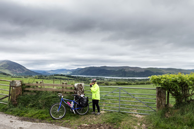
As the views opened out over
the Caldbeck Fells we enjoyed a long mostly downhill ride to Hesket
Newmarket. Here we turned right towards
Mungrisedale and accompanied by the wonderful coconut smell of flowering gorse
we really enjoyed the long flowing road under Carrock Fell.
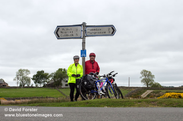 |
| Not too far from the end now |
 |
| Carrock Fell |
Just before we entered the village a left
turn took us in a loop over to Greystoke where we stopped at the little post
office cafe for...... yes you guessed it yet more food. On leaving Greystoke we
spotted the cyclists cafe (must visit it next time) and with the cycling still
on the gentle side we soon found ourselves dropping down into Penrith. On the last few hundred metres a couple of
passing cyclists welcomed us with a "just finishing"? "Well done".
A nice gesture and typical of the camaraderie we had experienced from
many people on the ride.
So would we recommend doing
the route, well in those 207 miles of wonderful cycling over 5 days there had
quite literally been many ups and downs, but with mostly warm sunny weather along with the spectacular cycling and views, we truly could not have asked for more. As for the issues with signs, don't let that
put you off, once the permanent ones with arrows are up it will be even better. In fact I think this will probably become a
bit of a classic route and I would happily do it again. In fact it would make a good video project,
so who knows.
Useful Links