Tuesday, 29 April 2014

Memories of Getting High


Sometimes you cannot help but be in a reflective mood when you sit atop some mountain with the breeze on your face and the world laid out at your feet.  The mountains tend to create a mood to reflect, plan and clear the mind.  It's the perfect location to defrag the hard drive of the brain, but that said, it can also be something of a melancholy experience.

The Picos De Europa 
I met a friend I had not seen for perhaps 20 years while on the hill the other day.  We chatted about what we had been up to, compared our ailments, discussed plans for the future and generally caught up.  When we parted I felt really unsettled, almost a sense of loss.  Not for the loss of a friend, but of a lifestyle that had not just slowly slipped away, but simply stopped overnight.  

The year 1995 was a time of wonderful highs in cleanest sense of the word.  By that I don't mean the highs a drug gives you, I mean those life long endorphin highs the mountains give you.  The kind that leave their mark etched on your brain - from mountains hard won, from fears controlled and of friendships and hardships shared.

Of grand routes in southern Spain and Majorca in the spring, and of warm rock and the smell of rosemary and thyme in the hills.  A time when you knew you were truly alive, not just existing. 

 Getting high on the Espolon Central route Puig Campana, Costa Blanca Spain

Route Gubia Normal Gr3, St Gubia Mallorca
Happy
Of nights sleeping below thousand foot faces with nothing but a bivy bag and a down jacket in order to keep the weight down. Cold seeping into the bones, wishing the night away in fitful dreams - half sleeping half awake - who knows? but time passed as it always has. 

And when sleep would not come lying there staring up at a billion stars, listening to the sounds of the mountains, their dark silhouettes etched against the pre-dawn sky. The purr of the stove, endless brews and wondering if the others were awake.  They usually were - well apart from Carl, he always slept. Then still in the dark the act of forcing stiff muscles and cold bones across to the base of the route.

Sunrise striking the tops, but an age away from warming our bodies, instead warmth had to come through activity and those first few shaky pitches.  Confidence rising with the sun as the sun line came down to greet us.  Welcome at first, but with the glare from the limestone it would soon become too hot. 

Picos de Europa

The crux building in the mind with each move, inching forward, the void dragging at your heels. Being careful not to over-reach, use the feet, shake out the arms and clip the pro. Suddenly it's over, big holds, more protection and the tension eases. 

Al on La Nani (D sup), South Face of El Naranjo De Bulness (Pico Urriellu) Picos De Europa

A few more moves and a bomber belay awaits.  Safety checks done, toes on the edge, let the rope take the weight and lean out.  Looking down hundreds of feet past unseen companions somewhere below the overhang. 


More pitches, a bit of banter and laughter and a pause for the odd photo.  Now and again a hint of fear as arms tire and the protection begins to space out. Suddenly shouting in Spanish - a curse, or a warning perhaps, but then the sound of a falling rock thrumming past over to the left. I wonder what the Spanish is for BELOW?  A bit more laughter - nervous this time - but no harm done the overhangs protect us..... for now!

Pitch after pitch, nearly three hundred metres worth. Then the crest, easy scrambling and the summit beckons.  


Approaching the Summit of El Naranjo De Bulness (Pico Urriellu) Picos De Europa 

Suddenly we hear voices, French, Spanish and German perhaps.  It's the summit - cracking views and a little Madonna statue watching over us.  Chatting with the other climbers in a mixture of gestures and badly pronounced language, more laughter, some food and drink - relax - but only a little because the job is only half done.

Time to head down, time to refocus.  An un-roped scramble into the amphitheater, followed by tense abseils to the base of the route.


Nearly there, just about to pull down the last rope and then an unmistakable shout in French from above "ATTENCION".  Stones clattering down, a moments panic and I learn a new Spanish word from the team beside us, "Va, Va" GO, GO and everyone ducks in close to the rock. 

Back to the bivy site we grab some more food and drink and then its the long, long walk back out in the afternoon heat.  A days rest and then do it all again.  I felt as if I was living my life in HD.

Those were the last big routes I ever did and two months later I was in hospital with a knackered back and nerve damage in one leg, waiting for an operation.  It was nothing to do with climbing, just a lifting accident at work that took it all away. It was a lifestyle lost, but it still lives on etched in my mind. 


Text images copyright David Forster

Sunday, 13 April 2014

A Lucky Escape and Tragedy in the Yorkshire Dales


The Pennine hills have borne witness to many stories of epic struggles, lucky escapes and of course tragedy.  These stories don't always relate to hill walkers, or other outdoor enthusiasts and it may surprise some to know that aviation plays a significant part in the history of these lonely windswept moors. 

The Pennines have always been a place to fear for aircrew facing bad weather, or mechanical problems and the remains of numerous aircraft that have failed to return to base are testament to this.

I recently planned a walk to explore the area around Castle Bolton and working on the theory that time spent doing research is seldom wasted I managed to find out there were two such air crash sites on the high ground to the north of the village.  One relates to a Gloster Javelin Jet, which crashed in 1959 and the other relates to a DeHavilland Mosquito TA525, which crashed in bad weather in 1946.

My initial plan was to head up Apedale and return via a track which runs from the mining grounds on Bolton Moor back to Dent's house in Apedale and a further look at the map showed I could take in the two sites with only minor detours.

This is open access land and after making my way along Apedale via the bridleway I struck off over the moor to find the general area where the Gloster Javelin came down. 

Being a grouse moor you can never be too sure of the welcome you will receive if you are spotted wandering around well away from established footpaths, but a friendly wave and smile from a passing farmer on his quad bike gave me a little boost of confidence.  I know I have every right to be there but I think I still have a few hang ups from all those years before right to roam where people were regularly hassled by over zealous gamekeepers and landowners who claimed that having people on the moors at any time of year (other than them of course) harmed the wildlife.  Years into the right to roam such opinions are now seen for what they were - rubbish - and if anything the presence of the public is probably helping the wildlife in that we can now see what goes on.

Anyway it was with thoughts like this rattling around my head that I continued on my way.  Weather wise while the sun was shining the wind was pretty strong at times and on a couple of occasions I was blown completely to a standstill.  Fortunately the wind unintentionally helped me and as I moved up towards some grouse butts I heard the clack clack of metal hitting metal carried on the wind.  After a bit of a scramble out of a deep peat hag I spotted the wreckage scattered across the fell side about twnety meters away. 

A general view of the crash site with one of aircrafts tyres

This was the site of the Gloster Javelin F.A.W Mk.5 XA662 of 228 Operational Conversion Unit which crashed here 29th September 1959.  The story behind the incident is that the crew took off from RAF Leeming and while over the North York Moors one of the engines developed a fault.  A short time later the second engine was also shut down due to a fire warning.  Fortunately the crew - Flying Officer C P Cowper and navigator Cpt R E Nietz successfully ejected from the aircraft and survived. 

Engine Jet-Pipe
The wreckage is pretty extensive and spread over an area of around 200m.  The engine jet-pipe is perhaps the largest visible component at around 10 feet long. 
 
 
Close up view of the Jet-Pipe

Many components are partly buried


The occasional rattle caused by the two pieces of metal above that kept hitting each other in the strong gusts gave the place a bit of an eerie feel and after grabbing a series of shots I soon moved on.

Joe Bosher gives a short account of his role as a member of the RAF recovery team here.
http://74th.co.uk/raf/service/castlebolton.html

The second aircraft lay a just over a kilometre as the crow flies on the other side of the hill, however as I also wanted to visit some of the mine workings here I struck off across the moor to have a look at these first.  Unfortunately very little remains of these other than collapsed shafts and spoil heaps and any photographic potential I thought they might have had when looking at the map was pretty limited, especially so considering it was midday and the light was rather harsh. 

Heading south I soon came across the shooting track which was followed for a kilometre or so to the area where the second aircraft lay.  Despite only having a general location for the aircraft I soon found the site.

This and some more wreckage further along the scar is all that remains of the De Havilland Mosquito TA525 which crashed here in thick cloud on the 14th February 1946, killing the 27 year old Dutch pilot Sgt Gebines La Hei instantly.  It is thought that Air Traffic Control had actually instructed him to climb but he did not manage to do so in time.


There is no memorial here only a pleasant view down the valley and the sad realisation that in those conditions there was little room for error and he probably only had seconds to react. 

There is a little more about the pilot and the incident itself here
http://www.yorkshire-aircraft.co.uk/aircraft/planes/dales/ta525.html


Text images copyright David Forster www.bluestoneimages.com

Tuesday, 1 April 2014

Helvellyn via Swirral Edge

While the weather was overcast it felt like spring had arrived as we left the campsite at Gillside Farm and sweated our way up towards Red Tarn. The illusion didn't last long and once we reached the col before the tarn we were met by a keen wind and soon changed back into winter clothing.

Across the tarn the north face of Helvellyn with its large cornices looked positively Alpine and it did not take long for us to decide on a quick break to take in the scene.

01M-8968 Helvellyn from Red Tarn in Winter Lake District Cumbria UK
Striding Edge on the left and Swirral Edge on the right, with Helvellyn in the Centre.
Our plan was to head up onto Swirral Edge and then enjoy an easy scramble onto Helvellyn. On the way up we met several people coming down who had abandoned their attempt on the summit because they did not have ice axes or crampons. Some even seemed surprised to find winter conditions up here! If you are heading anywhere in the Lake District it is worth checking out the Lake District Weatherline which provides a daily report on the conditions found on Helvellyn during the winter.

http://www.lakedistrictweatherline.co.uk/index

We soon made it onto the ridge seeking out the best scrambling to give some added interest. This was great fun and we followed the crest to get some shots which despite the hazy mist still gave a sense of exposure.

01M-9117 Enjoying the View from Swrirral Edge Helvellyn Lake District Cumbria UK
View towards Catstycam


01M-9063 Climbing Swirral Edge Helvelyn Lake District Cumbria UK
Moira and Sandra on the upper section


01M-9073 Hill Walker with Ice Axe on Swrirral Edge with Red Tarn Below Lake District Cumbria UK
Some nice exposure with Red Tarn below


01M-9185 Exiting Swrirral Edge Helvellyn Lake District Cumbria UK
Exiting Swirral Edge
We had a quick wander over to the summit, but after two busload sized groups turned up we plodded back to the Swrirral Edge exit cairn to have our lunch and watch a few lemmings without crampons, or ice axes gamble on a slide down to Red Tarn and afternoon spent with the local rescue team.

01M-9502 The Summit of Helvellyn and Striding Edge in Winter Lake District Cumbria UK
Looking along the cornice from the Swirral edge exit towards the summit

We then headed onto Whiteside and then down into Keppel Cove, before making our way back to the campsite via the high level path above Glenridding beck.

01M-9529 Photographing Swirral Edge and the Mountain of Catstycam in Winter Lake District Cumbria UK
Last shot with the view across Brown Cove of Swirral Edge and Catstycam
 

Text images copyright David Forster www.bluestoneimages.com


Wednesday, 12 March 2014

Land of Fire

With the arrival of some warmer weather I knew that the Adder (Vipera berus) would be out of hibernation so had a wander down to a hibernation site I have been observing for many years. Sure enough one individual was laying out in the sun enjoying a few rays. I had hoped to see several here and it is a bit worrying that there was only one.

06D-6159a Adder Vipera berus Sensing with Tongue
Adder Vipera berus.

At the moment the North Pennines moors are looking like some kind of apocalyptic landscape and everywhere you look there are fires and massive palls of smoke sweeping across the moors.

01M-8504 Heather Burning in Upper Teesdale County Durham


This is of course controlled heather burning but for anyone who has never seen such a practice it must look pretty alarming. Heather burning has been going on for generations and is done as a part of the grouse moor management and conservation and is completed just before the nesting season begins. The burning of old heather in a mosaic encourages new heather shoots to grow and ensures the grouse that feed on the shoots have plenty to feed on. It is not without controversy it has to be said, but it is certainly not a black and white argument.

It has to be said grouse shooting is an emotive subject and from my own personal viewpoint I have mixed feelings about it. On the other hand i know several families that rely on the income from these activities either directly as gamekeepers, beaters and other estate staff, or indirectly as suppliers, accommodation providers, etc. I must admit I find it difficult to understand the mindset of people who enjoy killing animals for fun, but as one gamekeeper pointed out to me, all of these birds go into the food chain and they are not left to rot on the moors. He does have a point and unlike some forms of intensive farming the birds do have a better quality of life. It is a part of the argument I find hard to pick holes in and if I am honest my dislike is perhaps more one based on the dislike of killing for fun as much as animal welfare or the effect on the environment.

Anyway opinions aside, I had a wander over to one of the fires to get some pics. This is access land but even so was not sure what sort of welcome I would receive. Fortunately the keepers were friendly enough and using a long lens I was able to zoom into the action without getting in the way.


06D-6350 Heather Burning Teesdale County Durham UK


06D-6362 Gamekeeper Controlling Heather Burning in Upper Teesdale County Durham


06D-6438 Gamekeeper Controlling Heather Burning in Upper Teesdale County Durham


06D-6444 Gamekeeper Controlling Heather Burning in Upper Teesdale County Durham

Text/images copyright David Forster www.bluestoneimages.com

Tuesday, 11 March 2014

Weardale Wander - Carrs Top and Catterick Hill.

It's odd but there are a number of hills in Teesdale and Weardale that I have only ever been on as a result of mountain rescue searches and I have never stood on the top simply for enjoyment - the hills of Carrs Top and Catterick above Bollihope in Weardale being two such places.

It was time to put this right and in spring sunshine I left the car at Bollihope and made my way up towards the first hill, Carrs Top.  There is no official path to the summit of Carrs and it was simply a case of following various sheep and quad bike tracks in the general direction of the summit, stopping every now and again to look at anything that caught my eye. 

View south over Bollihope
 
It has to be said these moors are pretty barren at first glance but there are a few distractions in the form of collapsed shelters, cairns, old mine workings and bird life such as Golden Plover, Lapwing, Curlew and Skylark which were all seen and heard this morning.  On the lower slopes where the watershed comes together as Bollihope Burn, Ring Ouzel, Dipper and reptiles such as lizard and Adder can also be found.

With the honking of Geese from a pond on the other side of the valley floating over and the air alive with birdsong it really felt as if spring had arrived.  Mind you it felt a bit like this last year and the end of March beginning of April brought two big dumps of snow, so spring could still be cut short.

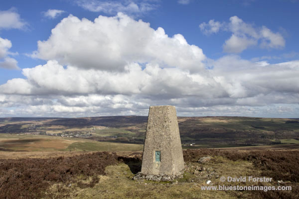
Carrs Top is only modest hill at 540m but it has long reaching views, which is why it has a trig point.  Its eastern end also has a small cairn with good views across to Catterick Hill, my next objective.


Cairn on Carrs Top with the view east to Catterick Hill in the distance
 

The view west across Weardale
 
Leaving the summit it was an easy if rather boggy walk to the road high point, which was crossed at right angles before making my trackless way towards the summit of Catterick (426m).  

Cairn on Catterick Hill with the OS trig point in the distance
 

Trig on Catterick Hill and the view north over Weardale
 
Moving west from the summit I made easy progress across trackless heather and after three hundred metres or so cut south towards some old mine working with lots of mineral coated rocks and some nice pieces of Fluorspar.  In fact the whole area has been mined and earlier in the day I even found a massive boulder at least 6 feet square that was completely coated in crystals.  The location of that particular gem is staying a secret for others who enjoy getting off the beaten track to find. 


Crystal rock close up
 
Making my way steeply down towards Bollihope I came across two holes that had recently opened up due to the heavy rain.   If you do intend walking in this area it is definitely worth keeping this in mind especially when walking in deep heather.


Several holes have opened up including one which drops into the nearby mine level that is not fenced off
 
Walk Date 3rd March 2014

Just as a postscript to this walk I headed back over this way the next day and noticed that a small hill called Long Man had some good light on it so made the short walk up.

Long Man Cairn
 
 
Oddest bit of littering I have ever seen
 
Rammed rather unceremoniously in the cairn was a plastic cremation Urn.  Needless to say I did not look inside and it may have been empty so perhaps they had already scattered the ashes.  It seems a shame to despoil the place by dumping it on the cairn though. 

Images/text copyright David Forster www.bluestoneimages.com


Monday, 24 February 2014

Surrender Bridge and the Old Gang Smelting Mills Circular

I know there has not many posts of late, but despite the grim weather I have actually been out and about walking and photographing a fair bit.  Unfortunately with my business under threat from a number of companies and individuals who have been breaching my copyrighted work the blog has had to take a back seat.  This has become such a problem that I will be naming and shaming those involved in a future post.

Anyway to try and forget the stresses and strains of eeking out a living as a photographer, Moira and I headed over to Surrender Bridge to do a circular walk up onto Great Pinseat, retuning via Hard Level Gill and the Old Gang Smelting Mills. 

Over the years we have done this walk on numerous occasions and in all weathers yet never seem to find it boring.  As the navigation around the route is a doddle we thought we would also add a bit of interest and test out my recently repaired Satmap Active 12 (Beta version) by trying to locate 3 Geocaches that are hidden along the route. If you don't know what Geocaching is you can get more info here. www.Geocaching.com

We parked up across the valley from the Surrender Bridge Smelting Mill


The remains of the Surrender Bridge Smelting Mill from the parking area

Within a few minutes of setting off we soon discovered it was going to be one of those frustrating days where the weather was never the same for ten minutes at a time and after a rather windy and rainy stomp along the track past the aptly named Wetshaw Bottom we arrived dripping wet at the cairn that sits atop the moonscape of mine tips on the southern side of Great Pinseat.  Fortunately this coincided with a short sunny spell, but don't let the blues sky fool you, it was still nithering.


Cairn next to the track over the southern shoulder of Great Pinseat

After a quick bite to eat we used the GPS to find some clues which led us to the first of the Geocaches.  Later chased by yet another heavy shower we headed off down Forefield Rake to the next cache not too far from Flincher Gill. 
 

Geocache and the Satmap Active 12
 
After a quick break for a coffee we had an easy wander down the track to Level
House Bridge and on to the twin portals of the Brandy Bottle Incline which connects with the Old Gang Level further down the valley.


Level House Bridge

 
Twin portals of the Brandy Bottle Incline


We soon found cache number 3 and then headed down to have a look around the remains of the Old Gang Smelting Mill


Before having a leisurely wander back to our start point at Surrender Bridge.

Text/images copyright David Forster
 
 
Further Reading
Another account of a walk up this valley by fellow blogger Alen can be found here http://becausetheyrethere.com/2013/10/28/the-long-surrender-brandy-bottle-incline/


Friday, 14 February 2014

Donate and Display - The thin end of the wedge?


On the face of it this Donate and Display seems like a good way of raising income, however I sincerely hope I am wrong about this, but it must have been very costly to install a payment machine and with that in mind I suspect this is simply going to be the thin edge of the wedge and we will see drivers paying for access to the hills if they wish to park at Bowlees in the not too distant future.  No doubt the official line will be we have no plans at present to operate Pay and Display here and elsewhere in Teesdale.  Yea right.

 
Donate and Display at Bowlees in Teesdale
 
I have always been of the opinion that charging for car parking in areas where people access the countryside harms local businesses.  From a personal perspective I know it certainly does.  Whenever I visit the Lake District for example, if I have to pay excessive parking fees to go for a walk then I simply don't spend any money in the local shops, cafe's etc.  It is not about being stingy or anything like that, it is simply the fact that after being taxed the better part of a tenner in say the Thirlmere or Ullswater valleys, coupled with the cost of running a vehicle there is sod all left over.  In fact I don't think I have spent much in any of the shops or pubs in Glenridding since the parking charges were introduced years ago.  Prior to that it was always a pint in the pub, a meal, or whatever with my mates.
 
One argument often used is that if you arrive by public transport you won't have to pay.  For day walks I find this is a flawed argument and in some rural areas you will be lucky to find public transport running more than a couple of times a week never mind per day and if you are heading out climbing in winter try getting a bus before first light to give you the early start needed to leave a safety margin of daylight at the end of the day.
 
Nor do I subscribe to the un-elected bodies and career conservationists' views that high parking charges are required to protect the area.  I am well aware of the arguments about government cuts, path and landscape restoration, visitor centres with cafes that need subsidising as well as other arguments, but with rich corporations, (some of which do immense damage to the environment) escaping paying billions of pounds worth of taxes, we really do need to get our priorities sorted here.
 
Free access to the countryside should be a fundamental right regardless of personal income, or the manner in which you arrive at a given location. 
 
Anyway rant aside on a more positive note here's a pic of Holwick scars from yesterday as yet another heavy snow shower makes it way in.  Can't decide if I like the flat low contrast look, but then again the light was flat so that's how it was.


Holwick Scars Teesdale


Holwick village from just below the scars
 
 
Text/images copyright David Forster/www.bluestoneimages.com.